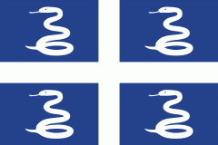
Le Lamentin (Le Lamentin)
Le Lamentin (Lanmanten; ) is a city and town, located in the French overseas department and region of Martinique. With its 62,32 km2, it is the town with the largest area of Martinique. Le Lamentin, with near to 40 000 inhabitants, is the second most populated town of Martinique, after Fort-de-France. It is also the first industrial town and the heart of the island's economy.
The town, incorporated in the region of Fort-de-France, is located in the center of the island of Martinique. Originally a giant swamp land and mangrove region, it is now a riparian town, located by the sea in the Bay of Fort-de-France and crossed by the island's longest river (36 km): the Lézarde.
The town, incorporated in the region of Fort-de-France, is located in the center of the island of Martinique. Originally a giant swamp land and mangrove region, it is now a riparian town, located by the sea in the Bay of Fort-de-France and crossed by the island's longest river (36 km): the Lézarde.
Map - Le Lamentin (Le Lamentin)
Map
Country - Martinique
 |
 |
It is thought that Martinique is a corruption of the Taíno name for the island (Madiana/Madinina, meaning 'island of flowers', or Matinino, 'island of women'), as relayed to Christopher Columbus when he visited the island in 1502. According to historian Sydney Daney, the island was called Jouanacaëra or Wanakaera by the Caribs, which means 'the island of iguanas'.
Currency / Language
| ISO | Currency | Symbol | Significant figures |
|---|---|---|---|
| EUR | Euro | € | 2 |
| ISO | Language |
|---|---|
| FR | French language |


